Texas Flood Disaster: Extreme Weather and Geography Combine for Tragedy
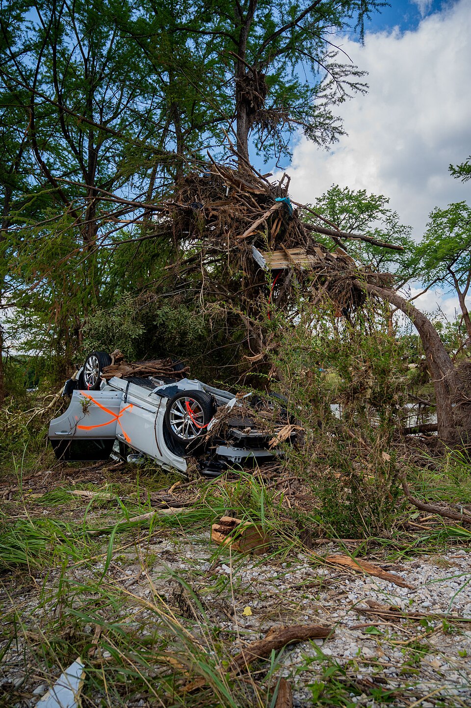
As a series of thunderstorms fueled by the remnants of Tropical Storm Barry unleashed their fury on Texas' Hill Country, the National Oceanic and Atmospheric Administration (NOAA) recorded unprecedented rainfall levels that overwhelmed their measurement systems. This catastrophic event, which occurred over the July 4th holiday weekend, has resulted in more than 100 fatalities, marking a significant disaster within a region historically vulnerable to flooding.
The storms produced by this weather phenomenon, deemed a 'worst-case scenario' by experts, were characterized by their unique confluence of atmospheric and geographical factors. According to Dr. David Gagne, a scientist at the National Center for Atmospheric Research, the combination of heavy rainfall, local terrain, and timing created conditions conducive to severe flooding. "All the ingredients came together at the wrong place, at the wrong time, at night on a holiday weekend," Gagne stated, emphasizing the critical nature of the event.
The Texas Hill Country, often referred to as 'flash flood alley,' is notorious for its steep hills, shallow soils, and geological features that exacerbate flooding risks. Texas state climatologist Dr. John Nielsen-Gammon noted that the storms stalled over the region, delivering between 10 to 12 inches of rain in just six hours, with the south fork of the Guadalupe River bearing the brunt of the deluge. This particular area lacks adequate rain gauges, complicating precise measurements and the assessment of the flooding's severity.
Historically, Texas leads the nation in flood-related fatalities, with 1,069 deaths recorded between 1959 and 2019, significantly higher than any other state. Research conducted by Dr. Hatim Sharif, a professor of civil and environmental engineering at the University of Texas at San Antonio, highlights that many of these fatalities occurred within the Hill Country. The region is shaped by the Balcones Escarpment, which acts as a barrier, intensifying storm activity as moist air from the Gulf of Mexico collides with the terrain.
Gagne reviewed the forecasting tools utilized by NOAA, indicating that while warnings were issued as rainfall rates began to escalate, the precision of these models often falls short in predicting localized severe weather events. "Even the most detailed weather forecasting models at this point are just barely capable of resolving individual convective storms," Nielsen-Gammon remarked, underscoring the limitations faced by meteorologists in accurately forecasting such intense and destructive rainfall.
As the floodwaters rose dramatically—approximately 20 feet in just over 12 hours, according to river gauges—local emergency response teams faced challenges in alerting residents. The lack of adequate warning systems, particularly in Kerr County where no sirens are in place, raises critical questions about preparedness and response protocols in flood-prone regions.
The implications of this disaster extend beyond immediate loss of life; they also highlight the need for improved infrastructure and emergency management strategies in Texas. As climate change continues to influence weather patterns, experts warn that regions like Texas Hill Country may experience more frequent and intense flooding events in the future, necessitating urgent attention to environmental resilience and community preparedness.
In summary, the tragic events in Texas serve as a stark reminder of the intersection between extreme weather, geographical vulnerabilities, and the necessity for advanced predictive capabilities to mitigate the impact of future disasters. The lessons learned from this disaster may shape policy and planning efforts aimed at protecting vulnerable communities from the devastating effects of climate-related flooding.
Advertisement
Tags
Advertisement