ESA's Biomass Satellite Unveils First Images of Global Forest Ecosystems
At the recent Living Planet Symposium, the European Space Agency (ESA) unveiled the inaugural images from its Biomass satellite mission, representing a significant advancement in remote sensing technology and environmental monitoring. Launched less than two months ago, the satellite is designed to provide critical insights into the Earth’s forests and their role in the global carbon cycle.
The Biomass mission, part of ESA’s FutureEO program, is equipped with a unique P-band synthetic aperture radar (SAR) capable of penetrating forest canopies to measure woody biomass, including trunks, branches, and stems. These measurements are crucial as they serve as a proxy for carbon storage, the primary objective of the mission. Michael Fehringer, ESA's Biomass Project Manager, stated, "As is routine, we’re still in the commissioning phase, fine-tuning the satellite to ensure it delivers the highest quality data for scientists to accurately determine how much carbon is stored in the world’s forests."
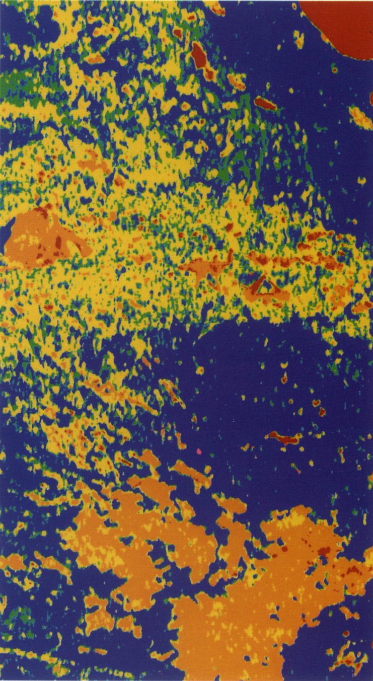
The first images released by Biomass highlight significant areas, including parts of Bolivia, which has experienced substantial deforestation, ranking among the highest globally for primary forest loss. According to a 2023 report by the World Resources Institute, Bolivia has lost approximately 25% of its forest cover in the last three decades, mainly due to agricultural expansion and infrastructure development.
In the released imagery, different colors represent various landscape characteristics: green hues indicate rainforest, red represents forested floodplains and wetlands, while blue-purple tones depict grasslands. Simonetta Cheli, ESA’s Director of Earth Observation Programmes, commented on the images, saying, "It’s clear to see that our Earth Explorer Biomass satellite is set to deliver on its promise, unlocking vital insights into carbon storage, climate change, and the health of our planet’s precious forest ecosystems."
The potential of the Biomass satellite extends beyond forest monitoring. Its advanced radar technology can penetrate dry sand up to five meters, allowing for the mapping of sub-surface geological features in desert regions. This capability is instrumental in understanding past climate conditions and identifying fossil water resources, as highlighted in a 2021 study from the National Aeronautics and Space Administration (NASA) that emphasized the importance of radar technology in geological studies.
Furthermore, the long wavelength of Biomass's radar allows for deeper penetration into ice, enabling researchers to gather data on ice velocity and the internal structure of glaciers, a feature not effectively achievable with shorter wavelength radars. This aspect is critical as climate change accelerates ice melt in polar regions, affecting global sea levels.
Biomass’s first images also include an acquisition over northern Brazil, showcasing its ability to penetrate dense vegetation. The radar’s capabilities reveal features down to the forest floor, with pink and red hues indicating the presence of wetlands. This demonstrates the satellite's potential for monitoring forest health and carbon stocks.
As the mission progresses, scientists expect to leverage the data from Biomass to enhance understanding of tropical forests' contributions to the global carbon cycle and address pressing environmental issues such as climate change. The anticipated findings from this mission could lead to more informed conservation strategies and policies aimed at forest protection and sustainable management.
In conclusion, the Biomass satellite mission signifies a transformative step in environmental monitoring, combining cutting-edge technology with scientific research to provide a clearer picture of Earth’s forests and their roles in mitigating climate change. The ongoing calibration and data collection processes will soon yield insights that could reshape global forestry and conservation efforts, ultimately contributing to a more sustainable future for the planet.
Advertisement
Tags
Advertisement